Short loop: Three Valleys Flow North
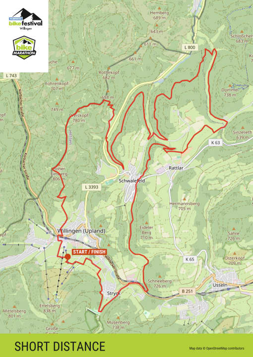
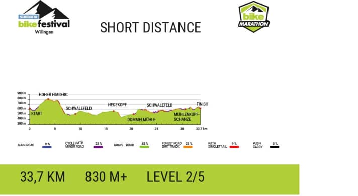
33.7 kilometres / 830 metres in altitude
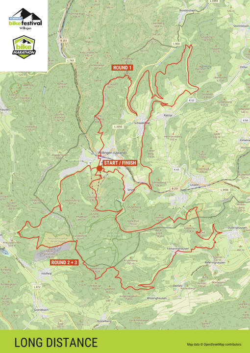
Every ambitious touring cyclist who enjoys flowy trails can tackle the short loop of the BIKE Marathon. After a short roll-in phase, the route climbs the longest ascent to the Hoher Eimberg (806 metres). That's 230 metres in altitude in one go, but the reward is immediate: a flowy trail stretches for 4 kilometres up here, first over to the Dreiskopf and then down towards Schwalefeld. You then get to know the green mountain flanks of the Ittertal, Aartal and Dommeltal valleys before one final 100 metre climb to the next highlight: At the top, a mix of trails and forest paths with an easy to sporty sawtooth profile takes you to the Mühlenkopfschanze and finally back to Willingen.
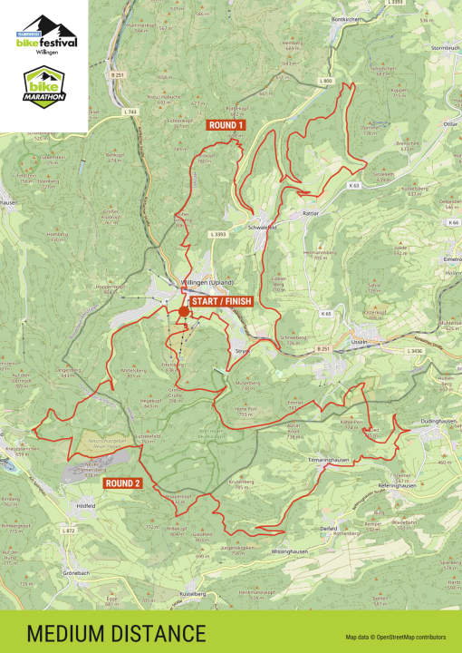
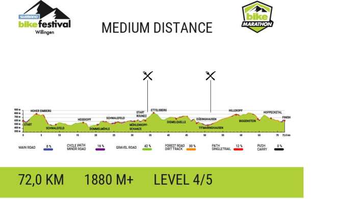
Medium loop: Summit trails south
71.8 kilometres / 1880 metres in altitude
If you opt for the medium loop, you will tackle a further, now more challenging, 1050 metres in altitude and, after the short loop, turn off not to the finish but into the steep climb up to the Ettelsberg. A short refreshment break at the Wilddieb, then it's on over the summit - now with the southern mountains of Willingen in your sights. You fly over the Große Grube towards the Strycktal valley. Collecting metres in altitude, panoramic points and the finest trail descents, the route continues around the Hohe Pön, over the Usselner Kreuz and over the Ka-Lied summit to Titmaringhausen. It's worth stopping at the refreshment station here, as the following climb up to the Hillekopf is 300 metres in altitude. At the top, the trail leads onto a high plateau and strolls for 5 kilometres through an idyllic nature park landscape - until the Biggenstein downhill finally grabs everyone's attention: steep, rough and root-ridden, this forest trail sabres your nerves and suspension. As soon as you have passed this 2-kilometre-long test, the next one piles up on the other side of the valley, because the climb is just as steep. Up here you have to crank up another 150 metres in altitude with an average gradient of 10 percent. At the end, however, the beautiful Hoppecke valley takes over and the last 5 kilometres are mostly downhill back to Willingen. Summary of this southern loop: tough, but above all a lot of fun. 42 percent of the route is on trails and narrow forest paths!
Long loop: expert circle
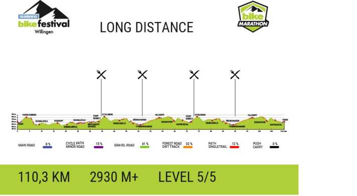
110 kilometres / 2930 metres in altitude
The kings of the long distance will opt for this additional 37.5 kilometres and 1050 metres in altitude. This means that after the medium loop, they will turn back onto the climb to the Ettelsberg and pump the southern loop into their legs a second time. But now with significantly less traffic and a clear path on the technical trail sections. To make the full throttle mode really worthwhile, there are also UCI points up for grabs on the long loop!
